
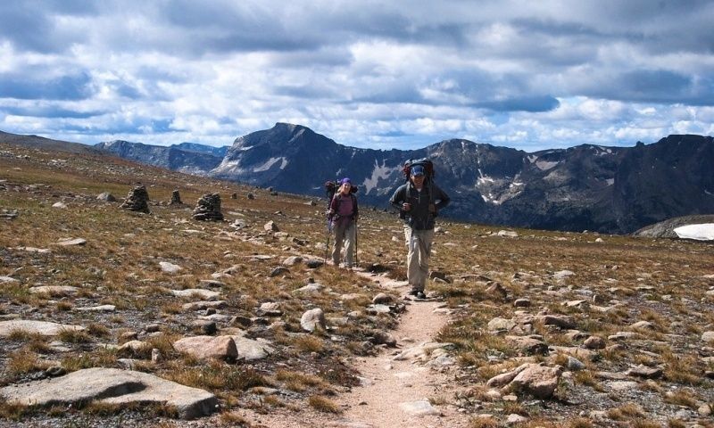
Crossing Lemhi Pass: How to Hike the Continental Divide Trail Where History Was Made
Standing at the Brink of Lewis and Clark’s Great Unknown
In August 1805, Meriwether Lewis climbed toward the crest of Lemhi Pass with a practical expectation that the hardest part of the expedition might soon be behind him. He was searching for a navigable waterway that would carry the Corps of Discovery toward the Pacific. Instead, from the high saddle, he saw range after range of mountains stretching westward. The landscape offered no easy river corridor and no gentle passage. It presented another formidable frontier.
Today, Lemhi Pass history remains inseparable from the Indigenous knowledge that made the expedition”s crossing possible. The Shoshone regularly used the route and knew the country far better than the newcomers. Guides led by Pikee Queenah, whom the expedition called Old Toby, helped carry supplies and directed the travelers toward the Lolo Trail. Sacagawea”s recognition by members of the Shoshone community also added a deeply human dimension to this encounter.
At roughly 7,373 feet, Lemhi Pass stands on the Continental Divide near the modern Montana and Idaho boundary. The saddle separates watersheds that ultimately flow toward the Missouri and Columbia river systems, making it both a geographic threshold and a historic one. For modern hikers, the area offers an unusual combination: a relatively accessible high-country destination, a powerful interpretive landscape, and a connection to the broader Continental Divide Trail. The road may bring you close to the monument, but the weather, isolation, and exposed terrain still demand the readiness of a genuine mountain expedition.
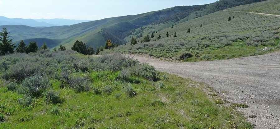
Seasonal Windows and Snowpack Realities Along the Divide
Lemhi Pass is high enough for winter conditions to linger well into the hiking season. Early summer can bring snowdrifts in shaded forest, muddy roads, swollen streams, and saturated meadows. Even when the pass itself appears open, nearby north-facing slopes may retain difficult snow. By midsummer, trails and Forest Service roads are generally more manageable, but afternoon thunderstorms can produce lightning, sudden rain, hail, and sharp temperature drops. Autumn often brings clear views and fewer insects, yet freezing nights, early snow, and rapidly shortening daylight change the character of every outing.
Long-distance hikers treat this stretch of the CDT as a scheduling puzzle rather than a simple summer walk. The broader experience of hiking the CDT shows why snow conditions, storm patterns, wildfire smoke, and route delays can reshape an itinerary even after careful planning. Section hikers should check current forecasts, snow reports, road notices, and fire restrictions before committing to a departure date. Conditions can vary dramatically between an exposed ridge and a shaded drainage only a few miles apart.
| Season | Likely trail and road conditions | Recommended preparation |
|---|---|---|
| Late spring and early summer | Lingering snow, mud, soft roads, possible drifts, cold nights | Traction devices, waterproof layers, gaiters, offline maps, flexible turnaround plans |
| Peak summer | Most reliable access, dry ridges, thunderstorms, mosquitoes, occasional smoke | Sun protection, wind layer, extra water capacity, bear storage, lightning awareness |
| Early to mid-autumn | Frozen mornings, possible new snow, shorter days, changing road conditions | Warm insulation, gloves, headlamp, emergency shelter, conservative mileage goals |
Thru-hikers and section adventurers often build a buffer into their schedules. A delayed road opening, a storm-bound pass, or a difficult blowdown section can consume an entire day. If the goal is to connect Lemhi Pass with a longer CDT segment, plan for conditions rather than dates alone. The best itinerary is one that can absorb a weather day without forcing a dangerous push into darkness or deteriorating terrain.
Navigating the Forest Service Roads to the Trailhead
Approach routes differ depending on which side of the divide supplies the expedition. From Montana, travelers commonly organize logistics around Dillon, Clark Canyon Reservoir, or the Lemhi Pass Road network. From Idaho, Tendoy and Salmon provide useful bases for fuel, food, weather checks, and last-minute supplies. Distances on a map can look modest, but Forest Service roads are slow, winding, and subject to washouts, ruts, fallen trees, and seasonal closures. A route that is straightforward in August may be impassable shortly after heavy rain or an early snowstorm.
A high-clearance vehicle is strongly advisable, particularly for the final approach over rough dirt roads. Four-wheel drive may be useful, but ground clearance, good tires, a full-size spare, and competent driving matter just as much. Do not assume that a large vehicle can turn around everywhere. Narrow sections, exposed edges, and muddy grades can make retreat more difficult than continuing, so check road conditions with the responsible Forest Service office before departure. The National Park Service”s account of the pass is valuable for historical context, but current road status must come from present-day land managers.
- Download topographic maps and satellite imagery before leaving cell service.
- Carry a paper map, compass, and written directions as a backup.
- Fill the fuel tank in Dillon, Salmon, or another suitable town rather than relying on remote availability.
- Inspect tires, brakes, fluids, lights, and the spare tire before taking the dirt road.
- Bring a jack and recovery equipment that work on uneven ground.
- Pack extra food, drinking water, warm clothing, and a basic vehicle emergency kit.
- Leave an itinerary with a trusted contact, including the access road and expected return time.
- Check closures, fire restrictions, recent storms, and washout reports on the day of travel.
Cell reception can disappear long before the trail begins. Treat the drive as part of the backcountry commitment, not as a routine transfer between paved roads and a trailhead. If heavy rain begins, reassess early. A vehicle stuck on a remote road can turn a day hike into a search-and-rescue problem, especially when no reliable way exists to call for help.
Step-by-Step Hiking Blueprint from Ridge Saddle to Historic Spring
The exact distance and difficulty of a Lemhi Pass outing depend on the chosen route and whether the objective is the pass monument, a historic spring, a CDT connection, or a longer descent into the surrounding country. The saddle itself provides a compact introduction to the divide, while nearby trails and roads allow hikers to build a half-day or full-day itinerary. Use current maps and local guidance, since alignments, signs, and road conditions can change.
- Begin at the pass saddle. Locate the historic monument and orient yourself with a map before starting. Take time to identify the divide, the state boundary area, and the broad drainage patterns visible from the ridge.
- Follow the established footpath or signed route downhill. Descending from 7,373 feet may feel easier than climbing, but loose surfaces and uneven ground can punish knees. Keep the route visible and avoid creating unofficial shortcuts through fragile vegetation.
- Watch for interpretive features. Monument cairns, signs, and historic references help explain the expedition”s crossing. Remember that the route was not an unknown wilderness to the Shoshone. It was part of an established travel landscape.
- Continue toward the historic spring or watershed feature. Water sources can be seasonal, muddy, or affected by livestock and wildlife. Treat all water before drinking, even when it appears clear.
- Pause at the basin and retrace the route conservatively. The return climb to the saddle is where elevation and fatigue become obvious. Begin back with enough daylight for careful navigation and allow additional time for weather changes.
The elevation profile is not extreme by western mountain standards, but starting above 7,000 feet changes the effort. Visitors arriving directly from low elevations may notice breathlessness, headaches, unusual fatigue, or slower recovery. Acclimatize with an easy first day, maintain a steady pace, drink regularly, and avoid treating the pass as a test of speed. A short pause to eat before the return climb can prevent a late-day energy collapse.
History is best experienced here at walking pace. Look for the relationship between the trail and the terrain, including the places where a loaded party would have sought water, chosen a grade, or paused to survey the country. Lewis expected a relatively simple crossing toward the Pacific; the view from Lemhi Pass corrected that assumption immediately. Standing among the monument, open slopes, and distant ridges makes that moment understandable in a way no map alone can provide.
Field Skills for Navigating Rugged Lemhi Backcountry
Wind is one of the defining conditions on an exposed divide. Carry a lightweight wind shell even on a warm forecast, along with a warm insulating layer, rain protection, gloves, and a hat. Footwear should match the surface, which may shift from firm trail to mud, talus, roots, or lingering snow. A headlamp, first-aid kit, emergency blanket or bivy, repair supplies, food reserves, and a reliable navigation system belong in every pack, including those carried on short excursions.
- Carry at least two navigation methods, such as a compass and downloaded map application.
- Bring more water capacity than the route length appears to require, especially for dry ridge travel.
- Use a filter or treatment tablets, and have a backup method if cold or silty water affects filtration.
- Pack high-energy food that remains usable in heat, rain, and cold.
- Use trekking poles for loose descents, stream crossings, and unstable snow.
- Carry bear spray where legal and practical, and know how to deploy it before entering bear country.
The Idaho-Montana border country supports black bears and grizzlies, along with elk, deer, mountain goats, and smaller wildlife. Make noise in dense vegetation and near running water, travel in groups when possible, and never approach wildlife for photographs. Store food, scented items, and garbage securely, keeping them away from your sleeping area. If you encounter a bear, do not run. Identify yourself calmly, increase distance, and follow current guidance from local wildlife agencies. Bear spray is a last-resort defensive tool, not a substitute for clean camps and alert travel.
Lemhi Pass can also serve as a gateway to larger CDT plans. Experienced section hikers may connect southward toward Bannock Pass or northward toward Chief Joseph Pass, but those journeys involve more mileage, complex navigation, variable water availability, and potentially rough trail conditions. Accounts from the surrounding CDT include freezing rain, snow-covered slopes, downfall, swamps, dry stretches, and repeated route-finding challenges. Some sections may offer road walks or resupply opportunities, yet remoteness remains the controlling fact.
Before extending the trip, study the full route rather than relying on the pass as a single reference point. Identify bailouts, reliable water, possible campsites, road crossings, and places where a vehicle or support person could reach the trail. Let someone know the intended direction and estimated completion date. The spirit of the historic expedition belongs in the curiosity and endurance of the journey, not in copying its lack of reliable forecasts, communication, or emergency support.
Claim Your Own Frontier Across the Great Ridge
A hike across Lemhi Pass compresses a remarkable story into a landscape that can still feel immense. The monument recalls the Corps of Discovery, but the surrounding terrain also points to the Shoshone people whose knowledge, travel routes, and assistance were essential to the expedition”s progress. The divide remains what it was in 1805: a place where expectations meet the scale of the mountains.
Prepare for the road as carefully as the trail, choose a season with realistic snow and weather margins, and carry enough equipment to remain safe when plans change. Respect wildlife, protect alpine vegetation, treat water, and leave historical features undisturbed. Then step onto the saddle with patience and attention. Lemhi Pass offers more than a scenic stop; it offers a direct encounter with geography, Indigenous travel knowledge, frontier history, and the enduring challenge of moving confidently through wild country.